Pathway into History
A Wagon Road Becomes a Highway
The “Pathway into History” road has had at least four names: The Pleasant Valley Wagon Road, the Rainbow Route, U.S. Highway 50, and Fremont County Road 45.
Early Roads
In the 1860s, the route from Cañon City to the Upper Arkansas followed Indian trails. Joseph Lamb was one of the hardy and adventuresome individuals that packed burros and made the journey.
Fremont County improved the trail in 1872, creating a road that stagecoaches could travel between Cañon City and Poncha Springs. However, the new wagon road still went from Cañon City to Texas Creek then dropped down to Pleasant Valley at Coaldale. By 1873, freight wagons, stagecoaches, and horses used the dust path alongside the river to take supplies to the growing mining towns. Horse and buggy, freight wagons and stagecoach faded into memory as the bicycle and automobile came into their own during the early 1900s. Later, the decision was made to shorten the route by going through the “Grand Canyon of the Arkansas.” Even though convict labor performed some of the work, the project cost the county $50,000 and the state $100,000. The highway was completed in September, 1015, and designated as the Rainbow Route. In 1927, the Federal Government requested that all interstate roads be designated as U.S. highways, and the Colorado Highway Department renamed the Rainbow Route U.S. Highway 50.
Building New Highway 50
Gaze across the river and imagine a solid rock wall plunging right down to the water. That is what highway engineers faced when planning a modern road in the early 1930s.
Although major improvements to the old road had been wanted for some time, sufficient funds and help from the Federal Government for road improvement projects such as the new U.S. Highway 50 finally became available during the Great Depression. Planning a modern highway required more space then was available along the railroad on the north side of the river. Since a highway could not displace an existing railroad, the only location available for the new U.S. Highway 50 was the south side of the river, a difficult and expensive undertaking.
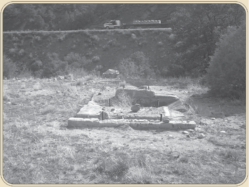
Rock had to be blasted and carved away to make the roadbed, and the debris had to be hauled out. The only way to move this solid rock was to use an air compressor and engine solidly mounted to concrete—the pads seen here. Air was piped across the river to run jack hammers for breaking the rock walls. An average of 216 men worked for two months to complete the project in 1935. The new highway had two fewer bridges than the old road and was designed to be paved when money became available. Fremont County designated the old road where you stand as County Road #45.
River and Road Connect Communities
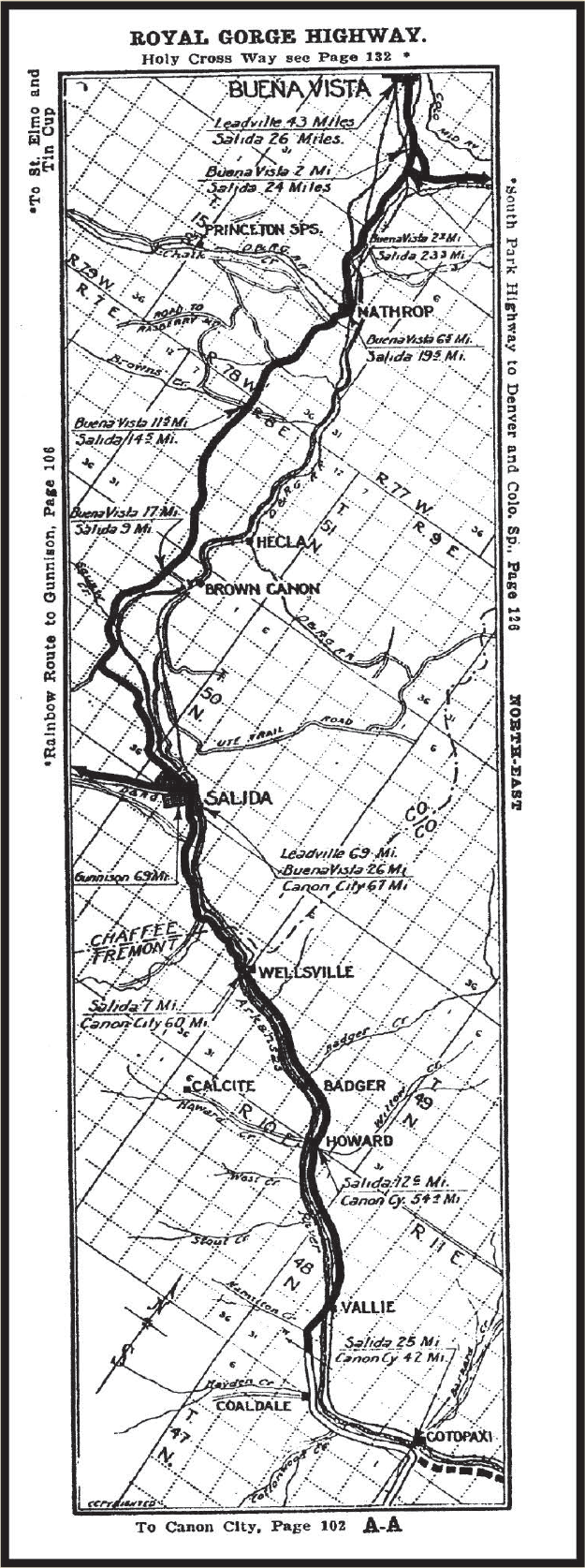
Since the dawn of the automobile age, tourist promotions published Colorado road maps. The old road tourist map of 1913 indicates the Rainbow Route improvements had begun but were not yet completed through the Arkansas River canyon from Cañon City.
Map courtesy of Stan and Mary Francis (from Highway of Colorado Official Guide and Tour Book—1912)
Click the image to the left for a full-sized version
A Community Grows and Needs Better Roads
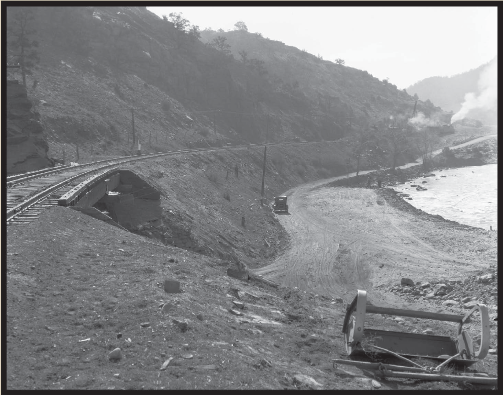
Even with improvements, the rough gravel road was a challenge for light trucks to negotiate. During heavy rains, the underpass would flood, making vehicle travel treacherous
A Foundation for Progress
To construct the new U.S. Highway 50 across the river, large heavy equipment was moved by the railroad to the construction sites along this side of the river. Where stationary equipment could be located, substantial concrete bases were laid to secure the machinery.
Photo courtesy of Roger and Yvonne Stromberg, 2004
Click the image above for a full-sized version


